
This post may contain affiliate links. When you purchase something through these links, I receive a small commission that helps me create this blog’s content. There’s no extra cost to you. Read my privacy policy to learn more.
Published 1/31/2022
Experience Minnesota Winter Hiking at Jay Cooke State Park
For me, the best Minnesota getaways include a little hiking, even in winter. I’d like to tell you that’s why we ended up in a VRBO basically in Jay Cooke State Park’s backyard in January 2022. But in actuality, our first Airbnb unexpectedly cancelled our reservation just days before our scheduled arrival. Happily, this mandatory last-minute lodging switch landed us in the aptly named Trailhouse.
Located just minutes from a Minnesota state park and the Superior Hiking Trail, we could have spent our whole weekend hiking in the snow-covered forest. We took full advantage of our vacation rental’s rural Minnesota location to do some hiking in Jay Cooke State Park. A little crisp Minnesota winter air and hiking on the state park’s extensive network of trails elevated a great weekend to amazing.
How to get to Jay Cooke State Park
You often hear Jay Cooke State Park referred to as Duluth’s state park. However, the park’s actually closer to Carlton, a tiny town about 20 miles south of Duluth. Truthfully, Jay Cooke State Park lives a little woodland world all its own. When you visit, it’s hard to believe a bustling city and busy interstate lie only minutes away.
Directions to Jay Cooke State Park from the Twin Cities/south: From I-35, take exit 235 (Black Bear Casino) and turn right/east onto Minnesota State Highway 210. Drive approximately 4 miles to reach the park’s entrance. The Visitor Center, as well as the park’s most iconic site, the Swinging Bridge, is about a 6-mile drive from the I-35 exit.
Directions to Jay Cooke State Park from Duluth/north: From I-35, take the left hand exit 251B (Grand Avenue), onto Minnesota State Highway 23 South. Drive 9 miles down MN 23, then take a slight right onto Minnesota State Highway 210. Continue 4 miles to reach the Jay Cooke State Park Visitor Center and Swinging Bridge.
Note: Minnesota State Highway 210 near Jay Cooke State Park is very windy and hilly. Reduce your speed and use caution on this portion of the drive, especially in winter. You’ll want to go slow to enjoy the beautiful St. Louis River gorge views anyway.
What Jay Cooke State Park Is Known For
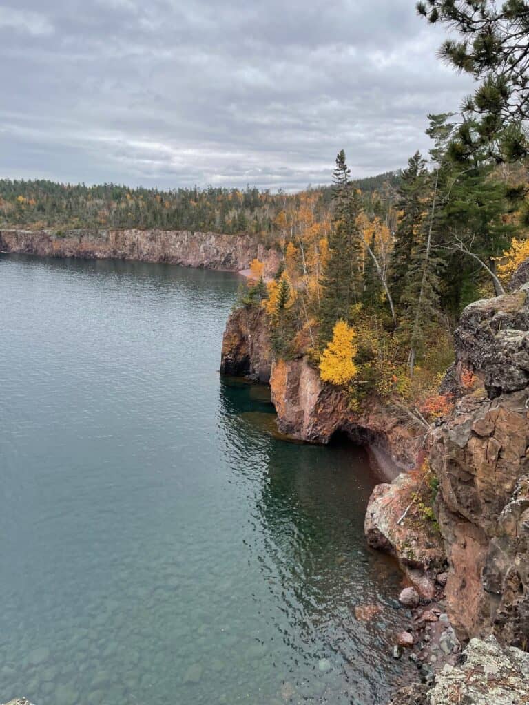
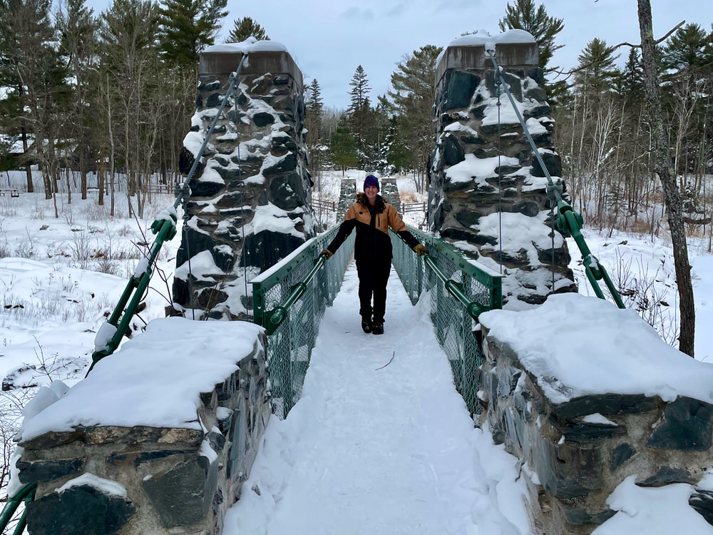
One of Minnesota’s oldest state parks, Jay Cooke State Park was established in 1915 with a land donation from the St. Louis River Power Company to the state. Now the park extends far beyond the boundaries of that original donation, covering over 8000 acres of hardwood forest. The park’s best-known features include a 200 ft long suspension bridge, dramatic St. Louis River gorge views, rock formations, and historic Civilian Conservation Corps (CCC) buildings.
Jay Cooke State Park has always highlighted the beautiful St. Louis River. In the park’s early days, a pretty janky suspension bridge allowed visitors to cross the wide, powerful St. Louis River Rapids. Luckily, the CCC constructed a much sturdier suspension bridge in the 1930s and early 1940s. This bridge quickly become the park’s most beloved (and most photographed) features. Then in 2012, a flood of almost Biblical proportions swept away the 126-foot suspension portion of the bridge. Don’t worry – it’s reconstructed and as good as new.

Several other CCC-era masonry structures dot the park. Constructed of local stone, these buildings are all listed on the National Register of Historic Places. The park uses the largest structure, the River Inn, as the Jay Cooke State Park Visitor Center.
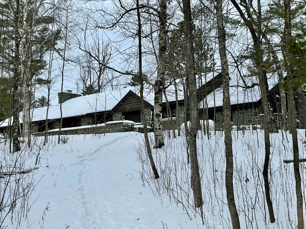
Visitors to Jay Cooke State Park primarily come to camp and use the park’s 50-mile network of recreation trails for hiking, biking, rollerblading, horseback riding, and cross-country skiing. The trail system connects to two long distance trails: the Superior Hiking Trail and the Willard Munger State Trail.
Human history infuses the park, starting with use by Indigenous people. In the fur trade days, Voyageurs portaged around the rapids we now come to photograph via a 6.5 mile long “Grand Portage.” In addition to the historic CCC buildings, you’ll find a pioneer cemetery within the park’s borders.
All about the St. Louis River
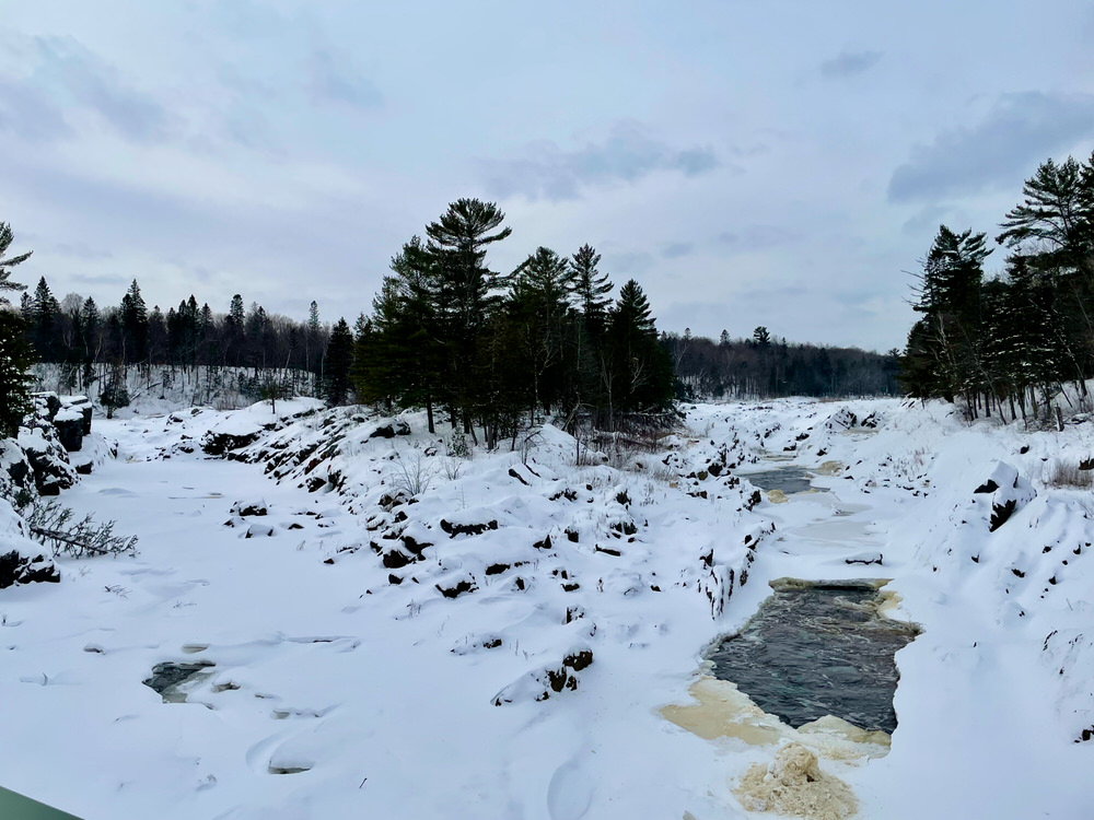
Whichever way you approach Jay Cooke State Park, you’ll pass hydroelectric dams and plants. Not exactly shocking (pun intended – haha!) considering the park owes its existence to a power company. These 14 separate dams (18 total dams) use the powerful, churning St. Louis River to generate power distributed by Minnesota Power. When this complex – the Thomson Dam Complex – opened in 1907, it was the second largest hydroelectric plant in the world!
The St. Louis River starts near Hoyt Lakes on Minnesota’s Iron Range. It runs for 192 miles through northern Minnesota to Lake Superior. When you come over Thomson Hill on I-35 as you approach Duluth from the south, you spy the river’s freshwater estuary formed at its entrance into Lake Superior.
Although Jay Cooke State Park provides a peaceful, wilderness escape from the metropolis of Duluth, it’s interesting to note that the St. Louis River was once one of the most polluted waterways in Minnesota. An impressive clean-up effort started in the 1970s and continues today. Fish caught in the St. Louis River still have an alarmingly high mercury content, so catch and release fishing is the way to go if you opt to wet a line.
Who was Jay Cooke?
Jay Cooke was a 19th century Philadelphia banker who made his millions in the American Civil War selling war bonds to support the Union. After the war, wanting to diversify his finances, he invested in the Northern Pacific Railroad project. This proposed railway line would run from Carlton, MN to Puget Sound in Washington State.
When Cooke arrived in Duluth in 1868 to survey his investment, he found sparely populated Minnesota wilderness with little transportation infrastructure. To reach the proposed starting point of his railroad in Carlton, he needed to boat up the St. Louis River. Ever the opportunist, he recognized the raging river’s potential for powering industry. Right then and there, he decided to purchase a large amount of St. Louis River acreage.
Jay Cooke’s dream of using the St. Louis River to power industry was recognized twice. In the 1890s, the river briefly powered his St. Louis River Slate Brick Company. Two years after his death, Great Northern Power began generating electricity with the dam complex that still spans the St. Louis River today.
Cooke financed countless other regional projects that helped shaped the greater Duluth community. That said, his companies maybe weren’t always quite on the up and up. When his estate decided to donate the St. Louis River frontage left over from the hydroelectric project to the state of Minnesota, some $18,000 in back taxes were owed!
If you want to put a face on Jay Cooke, you can “visit” him at Jay Cooke Plaza in Duluth. A sculpture of him seated with a collie dog overlooks this plaza on East Superior St.
You can learn more about him from a DNR naturalist here.
Where to Hike in the Winter at Jay Cooke State Park
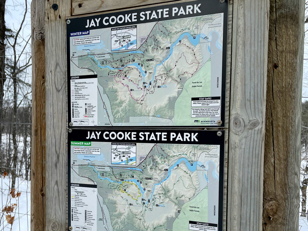
In the winter, the park grooms the majority of its summer trails for cross country skiing. With 32 miles of groomed ski trails, it’s a cross-country skiing paradise! But don’t even think about hiking on those groomed trails. Hikers ruin the grooming and pose an unnecessary obstacle for skiers. Since we didn’t have skis along, we had four main options for winter hiking.
Winter Hiking Trails at Jay Cooke State Park
Carlton Trail
Marketed as “rugged” and “steep” in the Jay Cooke State Park Trail Map, the Carlton Trail runs along the St. Louis River’s southern bank. Eventually the trail tees in with the Willard Munger State Trail. Since the Willard Munger State Trail is designated for snowmobile use in the winter, the Carlton Trail offers an out and back hike of up to 7.8 miles round trip. (In the summer you can make a nice 5-mile loop using a section of both the Willard Munger and Forbay Trails to make your way back to the Visitor Center.) Trailhead is at the Jay Cooke State Park Visitor Center and starts right after crossing the Swinging Bridge.
C.C.C. Trail
A flat, easy 1.8 mile loop trail that starts right in the main parking lot at the Visitor Center. Perfect for easy woodland immersion.
Grand Portage Trail
This moderate 3.2 mile loop takes you on a portion of the Grand Portage Trail used by French Canadian Voyageurs in the 17th and 18th century. The trail loops beside the St. Louis River and climbs a steep hill that Voyageurs called “the big hill.” Trailhead is located off of MN 210 near the eastern edge of the park. If you want a longer hike, the portion next to the river is part of the long-distance Superior Hiking Trail so you can continue east on that trail as far as your heart desires.
Ogantz Trail
An easy 1.8 loop trail with a dramatic, birds-eye view of the St. Louis River gorge. The trail makes a gentle loop down a large bluff and back up again. If you just want a short “leg-stretcher,” it’s a .2 mile hike to a developed overlook with several informational plaques about the park and individuals involved into its history. Trailhead is at Oldenburg Point Picnic Pavilion parking lot, about 1 mile east of the Jay Cooke State Park Visitor Center.

Our Jay Cooke State Park Winter Hiking Adventure
Although we visited on the first “warm” day in several weeks, we found a mostly empty parking lot when we pulled into the Visitor Center parking lot around 11 a.m. on a Saturday. We beelined it to the Swinging Bridge and after getting our obligatory photos, headed to the south shore of the river to start hiking. We immediately veered off on a user-developed trail beside the river . . . and promptly had to backtrack. Jenny and I scrambled up a not un-steep hillside to rejoin the actual trail system and after analyzing a trail map, realized we didn’t want to hike here at all.
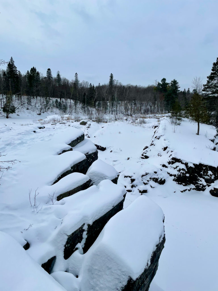
Since we weren’t skiing, the only trail available to us for hiking on the south side of the Swinging Bridge was the out and back Carlton Trail. The recent cold snap meant the river was almost complete frozen over and snow covered the unique rock formations that the park’s known for. With the visual appeal of this steep, rugged trail masked by snow, we decided to head over to the Ogantz Trail at Oldenburg Point Picnic Spot.
To snowshoe or not to snowshoe?
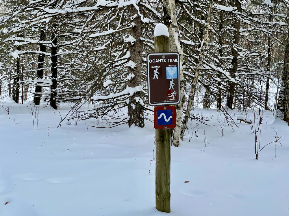
Trails designated for winter hiking at Jay Cooke State Park are marked with a snowshoe symbol on signs. But don’t feel that you must wear snowshoes. We did all our adventuring in boots and had zero problems. So many people do snowshoe the trails that we found the paths nicely packed for boot travel.
But don’t let me dissuade you from using snowshoes. Personally, I often find snowshoes more hassle than they’re worth so I often go to great lengths to avoid wearing them. We hiked the Ogantz Trail after about an inch of fresh snow had fallen and there were definitely some spots where we could have used snowshoes’ additional traction.

Hiking on the Ogantz Trail at Jay Cooke State Park
When we pulled into the Oldenburg Point Picnic Area, we didn’t know anything about the Ogantz Trail except that it’s 1.8 mile loop. Turns out the trail shares its name with Jay Cooke’s Pennsylvania mansion. Cooke named the house for his childhood friend Chief Ogontz of the Wyandot Tribe in Ohio.
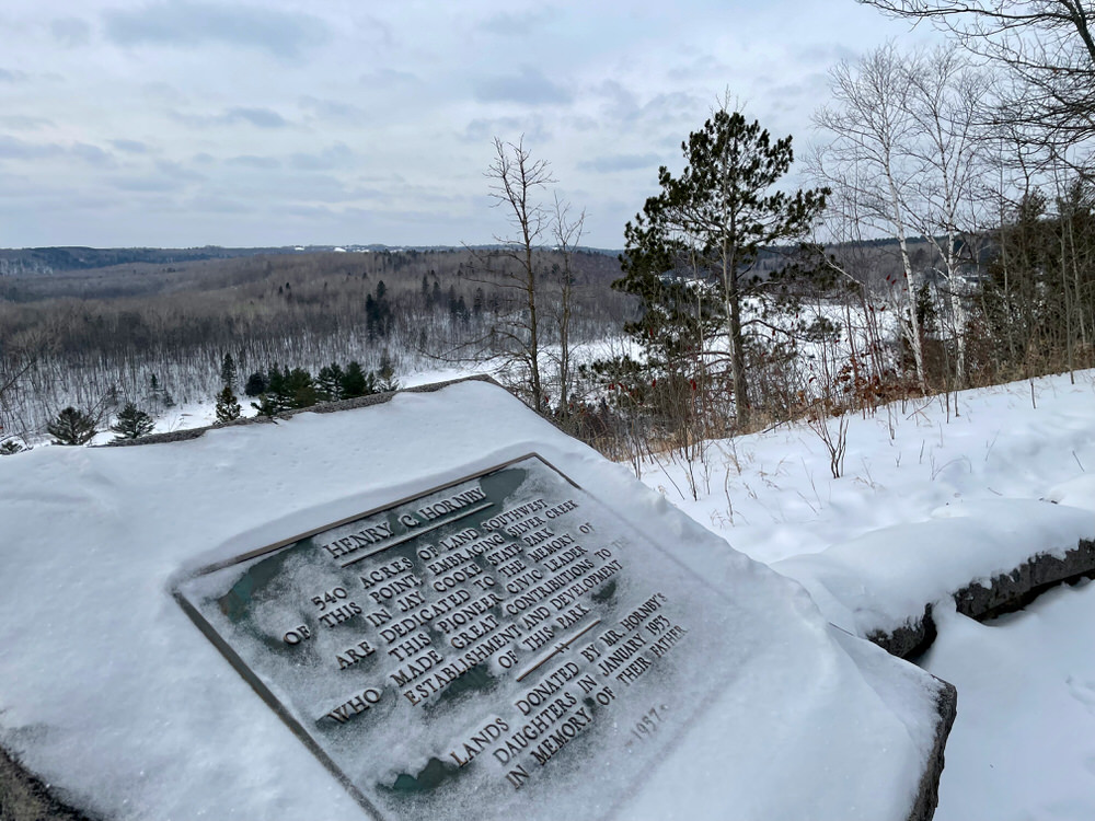
Oldenburg Point features a CCC picnic pavilion and water tower. The trail starts with two overlooks of the St. Louis River gorge. If you look very carefully, you can spy the Swinging Bridge way off in the distance. We scrapped snow off the various informational plaques at the second overlook to learn a little more about the development of Jay Cooke State Park. From there, the trail meanders downhill through the hardwood forest. After briefly leveling off, the trail then loops around to climb back up the hill to the parking area.
At about the trail’s halfway point, we ran into orange fencing that seemed to indicate a trail closure. However, there wasn’t any apparent reason for the closure and we could tell other hikers had ignored it. We just skirted around the fencing and continued on our hike. Sorry Park Service!
We really loved this trail. It was just the right mix of dramatic views and woodland exploration. If it weren’t for the frequent sound of BNSF freight trains rolling by in the distance, we could have convinced ourselves we were in the deep woods.
The trail demanded gentle exertion without leaving anyone winded or cramping. Except for seeing a couple groups in the parking lot, we had the trail completely to ourselves. It was just the breath of fresh air we all needed before returning to the Trailhouse to spend the rest of the day in the great indoors.
 |
 |